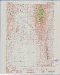
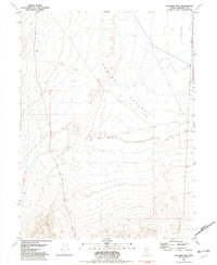
1990 Map of Purgatory Peak
USGS Topo · Published 1990About this map
Winnemucca Lake (Dry Lake) dominates the southern basin of this High Desert landscape, situated along the county line between Washoe and Pershing counties. The map documents a rugged transition from the arid valley floor to the high elevations of the Selenite Range and the Lake Range. Geographic interest centers on Purgatory Peak and Mt Limbo, while the western slopes of the valley reveal local history through sites like the Indian Caves near Falcon Hill. Human activity in this remote region is marked by utilitarian infrastructure, including a steel tower transmission line and scattered resource extraction points such as a Gravel Pit and a remote Prospect. Seasonal drainages like Jenny Creek and Jayhawk Creek emphasize the hydraulic patterns typical of the Great Basin topography recorded in this 1990 edition.
Find a feature on this map
16 named features on this map. Tap any name to fly to it.
Don’t see what you’re looking for? This feature index may not catch every label — zoom into the map to look around manually.
Map Details
Editions of this 1990 Purgatory Peak Map
This is the sole edition of this map. No revisions or reprints were ever made.
Other maps of this area

1886 · Granite Range
USGS Topo · 1:250,000

1894 · Granite Range
USGS Topo · 1:250,000

1955 · Lovelock
USGS Topo · 1:250,000

1959 · Lovelock
USGS Topo · 1:250,000
1964 · Tohakum Peak NE
USGS Topo · 1:24,000

1964 · Tohakum Peak NW
USGS Topo · 1:24,000

1964 · Kumiva Peak
USGS Topo · 1:62,500
1981 · Tunnel Spring
USGS Topo · 1:24,000
1981 · Betty Creek
USGS Topo · 1:24,000
1981 · Jayhawk Well
USGS Topo · 1:24,000