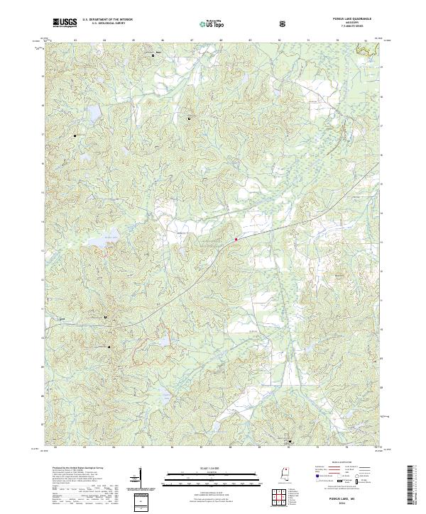
2024 Map of Puskus Lake
USGS Topo · Published 2024About this map
Holly Springs National Forest encompasses the center of this landscape, where the headwaters of numerous creeks converge near the Marshall and Lafayette County line. The terrain is defined by a dense network of drainages, including Puskus Creek and Cypress Creek, which feed into Puskus Lake and Cypress Lake. These water bodies and the surrounding woodlands provide a structured backdrop for the small settlements of Burt, Keel, and Liberty Hill.
Find a feature on this map
58 named features on this map. Tap any name to fly to it.
Don’t see what you’re looking for? This feature index may not catch every label — zoom into the map to look around manually.
Map Details
Editions of this 2024 Puskus Lake Map
This is the sole edition of this map. No revisions or reprints were ever made.
Other maps of this area

1942 · Denmark
USGS Topo · 1:62,500

1943 · Denmark
USGS Topo · 1:62,500

1944 · Potts Camp
USGS Topo · 1:62,500

1945 · Potts Camp
USGS Topo · 1:62,500

1949 · New Albany
USGS Topo · 1:62,500

1951 · New Albany
USGS Topo · 1:62,500

1955 · Blue Mountain
USGS Topo · 1:62,500

1956 · Tupelo
USGS Topo · 1:250,000

1958 · Tupelo
USGS Topo · 1:250,000
1980 · Thaxton
USGS Topo · 1:24,000