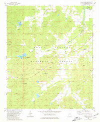
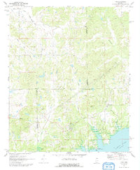
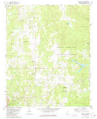
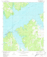
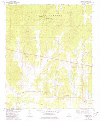
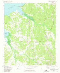
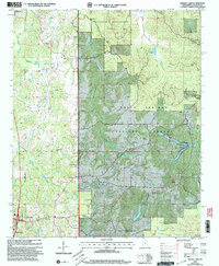
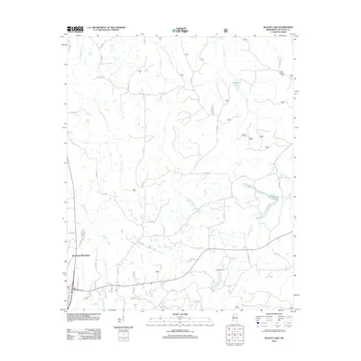
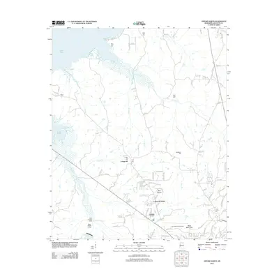
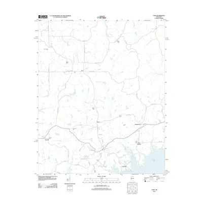
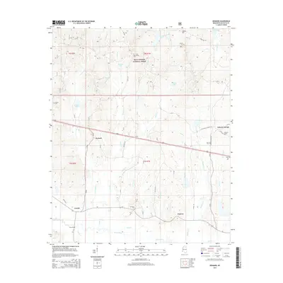
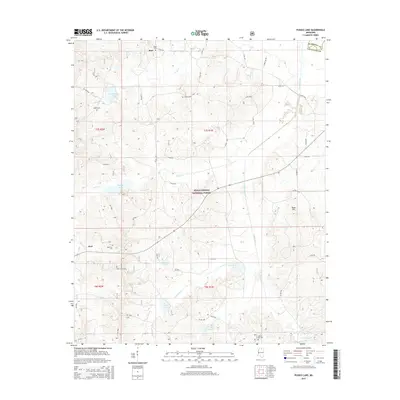
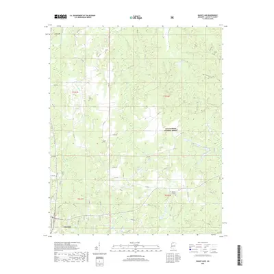
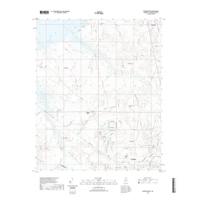
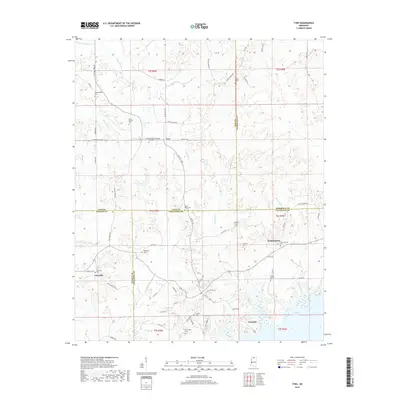
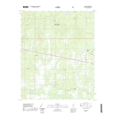
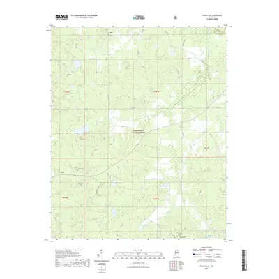
1980 Map of Puskus Lake
USGS Topo · Published 1981About this map
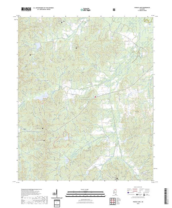
The Holly Springs National Forest dominates this northern Mississippi landscape, where the dense timber is bisected by numerous small drainages and isolated rural settlements. Small communities like Cambridge, Burt, and Keel are tied together by a network of unimproved roads and light-duty trails that navigate the undulating terrain of the Lafayette Co and Marshall Co line. Water resources are central to the area's development, featuring Puskus Lake with its dedicated Recreation Area and Boat Ramp, alongside the upper reaches of Cypress Creek and Wolf Creek. Genealogy and local history are particularly well-represented here through a dense concentration of rural landmarks, including Bethlehem Ch, Union Hill Ch Cem, and Shiloh Cem. These sites, along with several scattered sandpits, reflect an economy rooted in forestry, small-scale extraction, and long-standing community centers.
Find a feature on this map
40 named features on this map. Tap any name to fly to it.
Don’t see what you’re looking for? This feature index may not catch every label — zoom into the map to look around manually.
Map Details
Editions of this 1980 Puskus Lake Map
This is the sole edition of this map. No revisions or reprints were ever made.
Historical Maps of Burt Through Time
66 maps found
1942 Denmark
Lafayette County, MS
1943 Denmark
Lafayette County, MS
1971 Laws Hill
Lafayette County, MS
1971 Tyro
Lafayette County, MS
1980 Bagley Lake
Lafayette County, MS
1980 Coles Point
Lafayette County, MS
1980 Denmark
Lafayette County, MS
1980 Oxford North
Lafayette County, MS
1980 Oxford South
Lafayette County, MS
1980 Puskus Lake
Lafayette County, MS
1980 Splinter
Lafayette County, MS
1980 Yocona
Lafayette County, MS
2000 Bagley Lake
Lafayette County, MS
2000 Denmark
Lafayette County, MS
2000 Puskus Lake
Lafayette County, MS
2000 Yocona
Lafayette County, MS
2012 Bagley Lake
Lafayette County, MS
2012 Coles Point
Lafayette County, MS
2012 Denmark
Lafayette County, MS
2012 Laws Hill
Lafayette County, MS
2012 Oxford North
Lafayette County, MS
2012 Oxford South
Lafayette County, MS
2012 Puskus Lake
Lafayette County, MS
2012 Splinter
Lafayette County, MS
2012 Tyro
Lafayette County, MS
2012 Yocona
Lafayette County, MS
2015 Bagley Lake
Lafayette County, MS
2015 Coles Point
Lafayette County, MS
2015 Denmark
Lafayette County, MS
2015 Laws Hill
Lafayette County, MS
2015 Oxford North
Lafayette County, MS
2015 Oxford South
Lafayette County, MS
2015 Puskus Lake
Lafayette County, MS
2015 Splinter
Lafayette County, MS
2015 Tyro
Lafayette County, MS
2015 Yocona
Lafayette County, MS
2018 Bagley Lake
Lafayette County, MS
2018 Coles Point
Lafayette County, MS
2018 Denmark
Lafayette County, MS
2018 Laws Hill
Lafayette County, MS
2018 Oxford North
Lafayette County, MS
2018 Oxford South
Lafayette County, MS
2018 Puskus Lake
Lafayette County, MS
2018 Splinter
Lafayette County, MS
2018 Tyro
Lafayette County, MS
2018 Yocona
Lafayette County, MS
2021 Bagley Lake
Lafayette County, MS
2021 Coles Point
Lafayette County, MS
2021 Denmark
Lafayette County, MS
2021 Laws Hill
Lafayette County, MS
2021 Oxford North
Lafayette County, MS
2021 Oxford South
Lafayette County, MS
2021 Puskus Lake
Lafayette County, MS
2021 Splinter
Lafayette County, MS
2021 Tyro
Lafayette County, MS
2021 Yocona
Lafayette County, MS
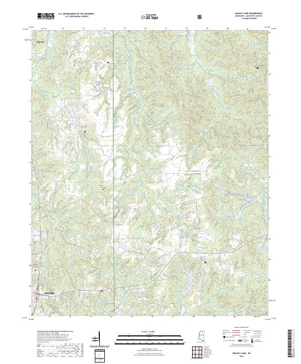
2024 Bagley Lake
Lafayette County, MS
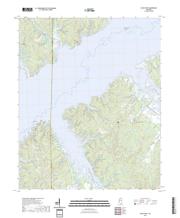
2024 Coles Point
Lafayette County, MS
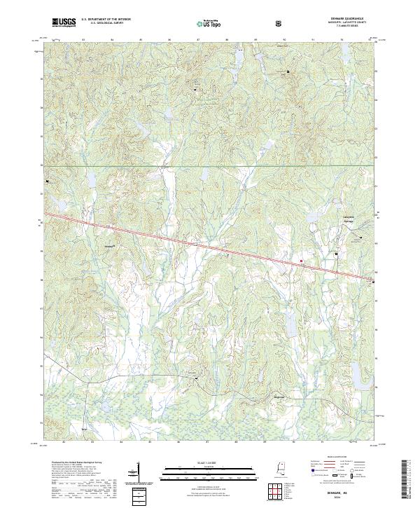
2024 Denmark
Lafayette County, MS
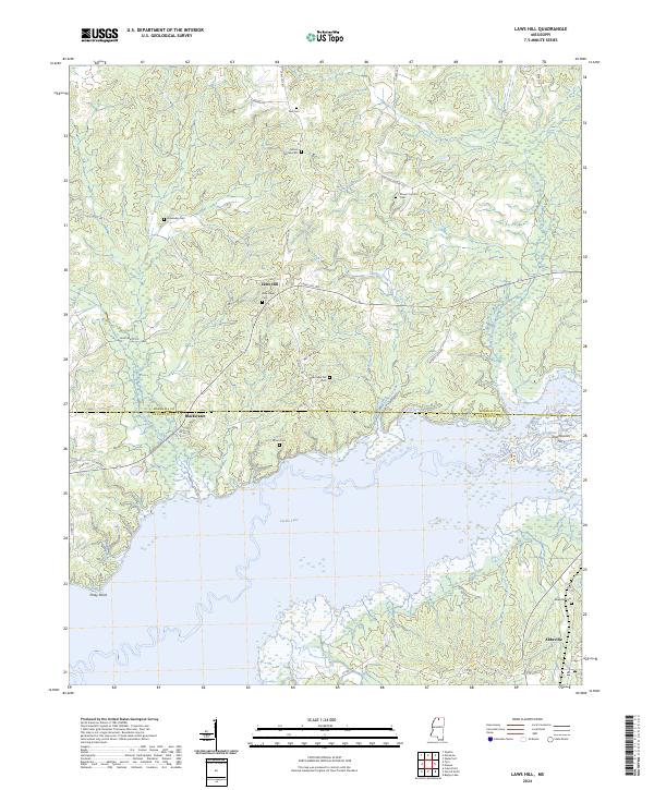
2024 Laws Hill
Lafayette County, MS
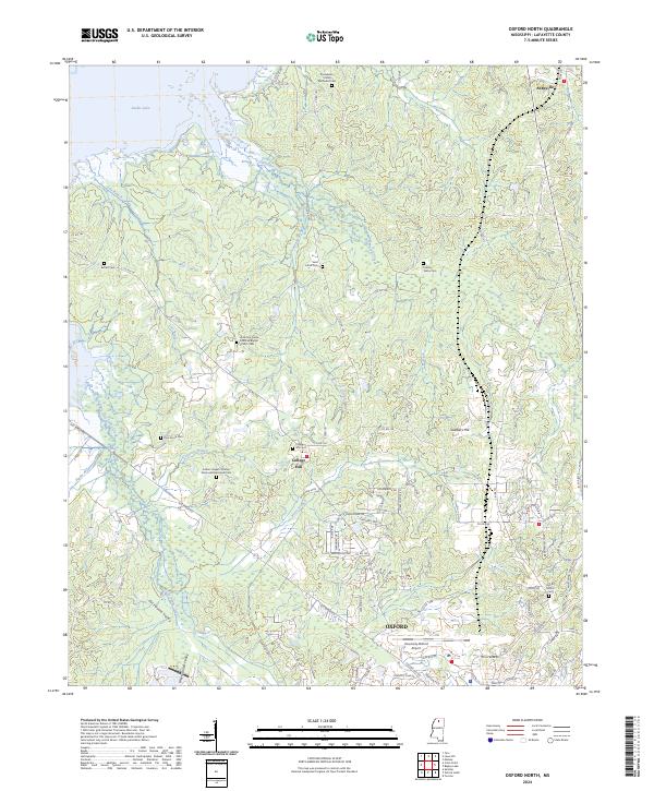
2024 Oxford North
Lafayette County, MS
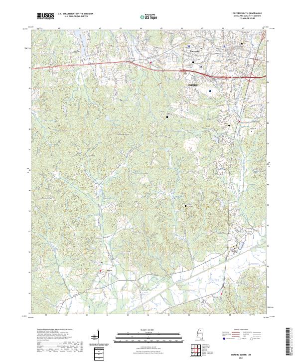
2024 Oxford South
Lafayette County, MS
2024 Puskus Lake
Lafayette County, MS
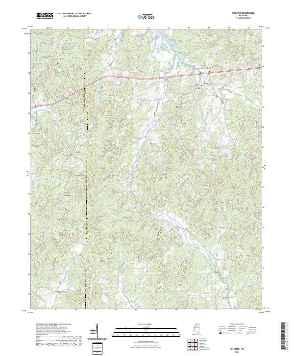
2024 Splinter
Lafayette County, MS
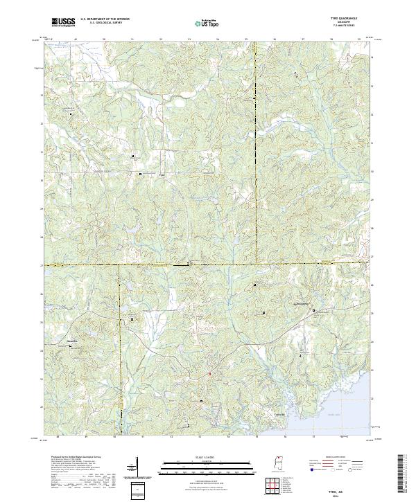
2024 Tyro
Lafayette County, MS
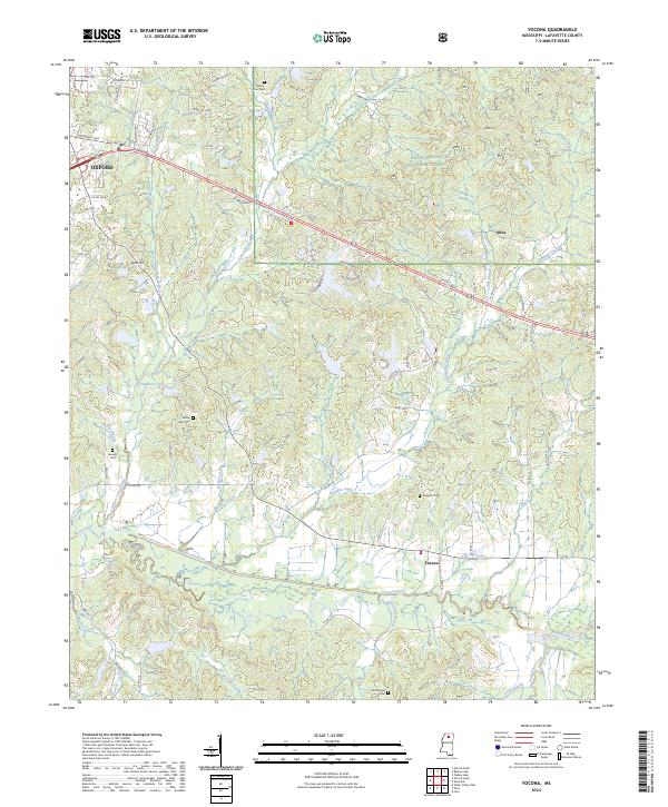
2024 Yocona
Lafayette County, MS