
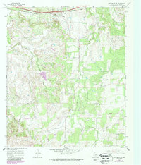
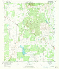
1966 Map of Putnam South
USGS Topo · Published 1969About this map
Putnam serves as the primary hub along the northern edge of this Callahan County landscape, situated along the Texas and Pacific railroad line. The settlement's proximity to the tracks and the nearby Water Tank reflect the enduring importance of rail transport to the local economy during the mid-1960s. To the south, the terrain transitions into more rural territory, where the small community of Atwell sits near the intersection of various local routes.
Find a feature on this map
15 named features on this map. Tap any name to fly to it.
Don’t see what you’re looking for? This feature index may not catch every label — zoom into the map to look around manually.
Map Details
Editions of this 1966 Putnam South Map
2 editions found
Other maps of this area

1931 · Baird
USGS Topo · 1:125,000

1932 · Baird
USGS Topo · 1:125,000

1954 · Abilene
USGS Topo · 1:250,000

1958 · Abilene
USGS Topo · 1:250,000

1966 · Scranton
USGS Topo · 1:24,000
1966 · Bernie Lake
USGS Topo · 1:24,000

1966 · Admiral
USGS Topo · 1:24,000
1966 · Putnam North
USGS Topo · 1:24,000
1966 · Jayell
USGS Topo · 1:24,000
1968 · Rowden
USGS Topo · 1:24,000