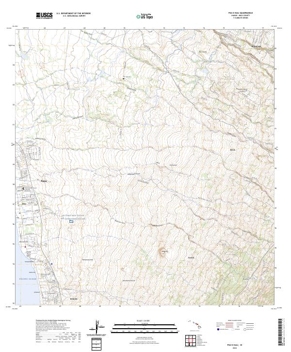
2024 Map of Puu O Kali
USGS Topo · Published 2024About this map
Coastal development and volcanic slopes define this landscape on the island of Maui, where the residential growth of Kihei and Wailea meets the Pacific Ocean. Along the shoreline, local markers like Charley Young Beach and the Trinity Episcopal Church By the Sea anchor the community, while the inland terrain rises sharply through a series of volcanic features including Pu‘uokali and Pu‘ukahala. The map highlights the complex drainage system of the island, characterized by numerous gulches such as Pulehu Gulch and Kulanihāko‘i Gulch that carve through the landscape toward the sea.
Find a feature on this map
84 named features on this map. Tap any name to fly to it.
Don’t see what you’re looking for? This feature index may not catch every label — zoom into the map to look around manually.
Map Details
Editions of this 2024 Puu O Kali Map
This is the sole edition of this map. No revisions or reprints were ever made.
Other maps of this area

1954 · Maui
USGS Topo · 1:250,000

1954 · Maalaea
USGS Topo · 1:24,000

1954 · Paia
USGS Topo · 1:24,000

1954 · Puu O Kali
USGS Topo · 1:24,000

1954 · Makena
USGS Topo · 1:24,000

1955 · Wailuku
USGS Topo · 1:24,000

1957 · Kilohana
USGS Topo · 1:24,000

1957 · Haiku
USGS Topo · 1:24,000

1957 · Lualailua Hills
USGS Topo · 1:24,000

1966 · Maui
USGS Topo · 1:250,000