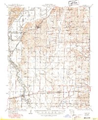
1934 Map of Puxico
USGS Topo · Published 1950About this map
The St Francis River and its complex wetlands dominate this 1930s landscape at the edge of the Ozark Foothills. Extensive drainage efforts are evident through a network of ditches and sloughs, including Mingo Slough and Rockhouse Cypress, which defined the local agricultural economy and settlement patterns. The town of Puxico sits as a primary hub, while the St L (Abandoned) San Francisco line already marks the shifting infrastructure of the early 20th century.
Find a feature on this map
85 named features on this map. Tap any name to fly to it.
Don’t see what you’re looking for? This feature index may not catch every label — zoom into the map to look around manually.
Map Details
Editions of this 1934 Puxico Map
2 editions found
Other maps of this area

1934 · Greenville
USGS Topo · 1:62,500

1934 · Bloomfield
USGS Topo · 1:62,500

1934 · Advance
USGS Topo · 1:62,500

1934 · Puxico
USGS Topo · 1:62,500

1935 · Poplar Bluff
USGS Topo · 1:62,500

1935 · Zalma
USGS Topo · 1:62,500

1935 · Harviell
USGS Topo · 1:62,500

1939 · Bloomfield
USGS Topo · 1:62,500

1939 · Greenville
USGS Topo · 1:62,500

1939 · Advance
USGS Topo · 1:62,500