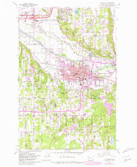
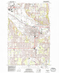
1961 Map of Puyallup
USGS Topo · Published 1981About this map
Puyallup and its surrounding river valley define this 1961 survey, showing the city's relationship with the Puyallup River and the local agricultural and educational infrastructure. The map documents significant sites like the Western Washington Experimental Station and the Fort Maloney Historical Marker, which points to the early pioneer history of the valley. Urban development is contrasted with the preserved open spaces of the Indian Reservation Boundary and the upland water systems near McMillin Reservoir.
Find a feature on this map
58 named features on this map. Tap any name to fly to it.
Don’t see what you’re looking for? This feature index may not catch every label — zoom into the map to look around manually.
Map Details
Editions of this 1961 Puyallup Map
5 editions found
Other maps of this area

1897 · Tacoma
USGS Topo · 1:125,000

1900 · Tacoma
USGS Topo · 1:125,000

1941 · Tacoma South
USGS Topo · 1:62,500

1942 · Lake Tapps
USGS Topo · 1:62,500

1944 · Lake Tapps
USGS Topo · 1:62,500

1944 · Tacoma South
USGS Topo · 1:62,500

1949 · Tacoma North
USGS Topo · 1:24,000

1949 · Poverty Bay
USGS Topo · 1:24,000

1949 · Auburn
USGS Topo · 1:24,000

1956 · Orting
USGS Topo · 1:24,000