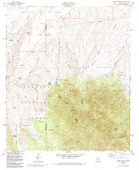
1958 Map of Pyeatt Ranch
USGS Topo · Published 1984About this map
The Fort Huachuca Military Reservation dominates the eastern half of this landscape, where the high peaks of the Huachuca Mountains rise above the surrounding canyons and washes. This 1958 survey, updated with revisions through the early 1980s, documents a rugged ranching and mining region along the Santa Cruz Co Cochise Co boundary. Working cattle operations like the Swinging H Ranch, Pyeatt Ranch, and Becker Ranch are situated near the seasonal drainages of Lyle Canyon and Turkey Creek.
Find a feature on this map
55 named features on this map. Tap any name to fly to it.
Don’t see what you’re looking for? This feature index may not catch every label — zoom into the map to look around manually.
Map Details
Editions of this 1958 Pyeatt Ranch Map
3 editions found
Other maps of this area

1904 · Patagonia
USGS Topo · 1:125,000

1905 · Patagonia
USGS Topo · 1:125,000

1905 · Nogales
USGS Topo · 1:125,000

1914 · Hereford
USGS Topo · 1:125,000

1915 · Benson
USGS Topo · 1:125,000

1922 · Sunnyside
USGS Topo · 1:62,500

1932 · Lochiel
USGS Topo · 1:62,500

1932 · Elgin
USGS Topo · 1:62,500

1938 · Huachuca
USGS Topo · 1:62,500

1938 · Sunnyside
USGS Topo · 1:62,500