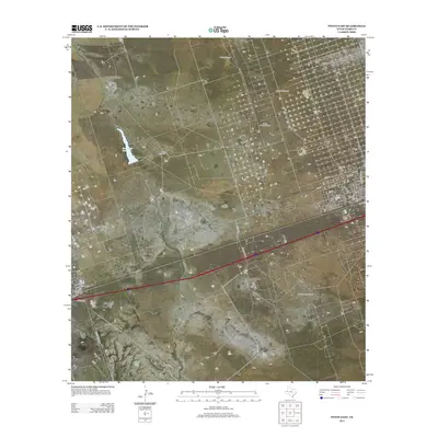
2013 Map of Pyote East
USGS Topo · Published 2013About this map
The petroleum-rich landscape of Ward County is clearly defined on this survey, where the industry's infrastructure dominates the high desert terrain. Extensive operations at the Wickett South Oil Field and the South Sealy Oil Field are connected by a network of local roads and state spurs. The settlement of Wickett is shown in detail, with its residential grid extending from 1st St up to 14th St and along T and P Ave. Outside the town center, the map reveals a sparsely populated ranching environment where water sources are vital landmarks. Key water-related features include Monument Pond and several named stations for cattle and drilling operations, such as North Windmill, Recorder Windmill, and the Half h Windmill. This map serves as a record of the modern energy economy of the Permian Basin, centered on the intersection of long-standing ranching properties like Tie Ranch and industrial expansion.
Find a feature on this map
29 named features on this map. Tap any name to fly to it.
Don’t see what you’re looking for? This feature index may not catch every label — zoom into the map to look around manually.
Map Details
Editions of this 2013 Pyote East Map
This is the sole edition of this map. No revisions or reprints were ever made.
Other maps of this area

1931 · Barstow
USGS Topo · 1:125,000

1954 · Pecos
USGS Topo · 1:250,000

1957 · Pecos
USGS Topo · 1:250,000

1963 · China Lake NE
USGS Topo · 1:24,000

1963 · China Lake
USGS Topo · 1:24,000

1968 · Wink South
USGS Topo · 1:24,000

1968 · China Ranch
USGS Topo · 1:24,000

1969 · Pyote NE
USGS Topo · 1:24,000

1969 · Pyote East
USGS Topo · 1:24,000

1969 · Monahans
USGS Topo · 1:24,000