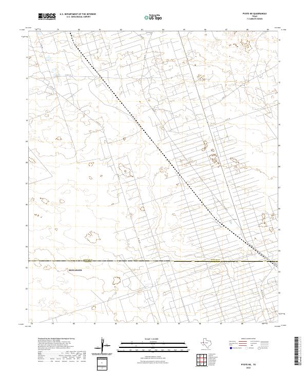
2022 Map of Pyote NE
USGS Topo · Published 2022About this map
Industrial and rural landscapes intersect along the border of Winkler Co and Ward Co in this 2022 survey. The territory is defined by a dense, systematic grid of service roads and well pads, reflecting the intensive energy production characteristic of the Permian Basin. While the southern portion of the map touches the outskirts of Monahans, the majority of the area is a working landscape of utility and extraction. Primary transit through this region is facilitated by Ranch Rd 1219 and a network of county routes including Co Rd 401 and Co Rd 209. The layout of these roads provides a clear record of contemporary land use, illustrating how mineral interests have shaped the modern geography of West Texas. Beyond the industrial infrastructure, the topography is marked by the shifting sands and subtle elevations that lead into the nearby state park system.
Find a feature on this map
11 named features on this map. Tap any name to fly to it.
Don’t see what you’re looking for? This feature index may not catch every label — zoom into the map to look around manually.
Map Details
Editions of this 2022 Pyote NE Map
This is the sole edition of this map. No revisions or reprints were ever made.
Other maps of this area

1954 · Pecos
USGS Topo · 1:250,000

1957 · Pecos
USGS Topo · 1:250,000

1968 · Wink South
USGS Topo · 1:24,000

1968 · China Ranch
USGS Topo · 1:24,000

1969 · Pyote NE
USGS Topo · 1:24,000

1969 · Pyote East
USGS Topo · 1:24,000

1969 · Monahans
USGS Topo · 1:24,000
1969 · Pyote West
USGS Topo · 1:24,000

1970 · Wink North
USGS Topo · 1:24,000

1970 · Kermit
USGS Topo · 1:24,000