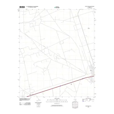
2010 Map of Pyote West
USGS Topo · Published 2010About this map
The town of Pyote anchors the eastern edge of this West Texas landscape, where the grid of Pyote St meets the transit corridor of State Loop 247. This 2010 survey illustrates the sparse but deliberate organization of the Permian Basin, defined by vast stretches like the Pyote Flats and a network of arterial roads including Ranch Rd 2355 and Co Rd 128.
Find a feature on this map
10 named features on this map. Tap any name to fly to it.
Don’t see what you’re looking for? This feature index may not catch every label — zoom into the map to look around manually.
Map Details
Editions of this 2010 Pyote West Map
This is the sole edition of this map. No revisions or reprints were ever made.
Other maps of this area

1931 · Barstow
USGS Topo · 1:125,000

1954 · Pecos
USGS Topo · 1:250,000

1957 · Pecos
USGS Topo · 1:250,000

1963 · Quito Draw
USGS Topo · 1:24,000

1963 · China Lake NE
USGS Topo · 1:24,000

1963 · China Lake
USGS Topo · 1:24,000

1968 · Soda Lake SE
USGS Topo · 1:24,000

1968 · Wink South
USGS Topo · 1:24,000

1968 · Soda Lake NE
USGS Topo · 1:24,000

1969 · Pyote NE
USGS Topo · 1:24,000