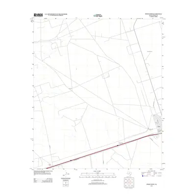
2012 Map of Pyote West
USGS Topo · Published 2012About this map
Pyote sits on the eastern edge of this West Texas landscape, defined by the transition from open range to the modern infrastructure of Ward County. This 2012 survey illustrates the grid of the town site, where streets like Woodard St and Wall St meet the corridor of W Interstate 20. The legacy of the railroad is preserved in the naming of T and P Ave, referencing the Texas and Pacific Railway that historically shaped the region's development. Outside the small settlement, the terrain opens into the Pyote Flats, a territory marked by isolated landmarks like Wilson Ranch and Rogers Windmill. The map tracks the network of county roads, such as Co RD-128 and Cord-4550, which provide access to the surrounding arid plains and local ranching operations.
Find a feature on this map
18 named features on this map. Tap any name to fly to it.
Don’t see what you’re looking for? This feature index may not catch every label — zoom into the map to look around manually.
Map Details
Editions of this 2012 Pyote West Map
This is the sole edition of this map. No revisions or reprints were ever made.
Other maps of this area

1931 · Barstow
USGS Topo · 1:125,000

1954 · Pecos
USGS Topo · 1:250,000

1957 · Pecos
USGS Topo · 1:250,000

1963 · Quito Draw
USGS Topo · 1:24,000

1963 · China Lake NE
USGS Topo · 1:24,000

1963 · China Lake
USGS Topo · 1:24,000

1968 · Soda Lake SE
USGS Topo · 1:24,000

1968 · Wink South
USGS Topo · 1:24,000

1968 · Soda Lake NE
USGS Topo · 1:24,000

1969 · Pyote NE
USGS Topo · 1:24,000