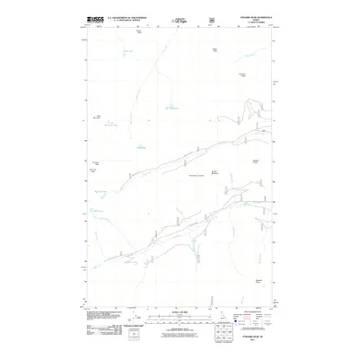
2011 Map of Pyramid Peak
USGS Topo · Published 2011About this map
Russell Mountain Lookout sits prominently above a landscape defined by sharp ridges and drainages in this 2011 survey of the Idaho panhandle. The area is characterized by an extensive network of creeks named for various nationalities and figures, including Swiss Creek, English Creek, French Creek, Swede Creek, and Irish Creek. These waterways descend from high points such as Pyramid Peak, Fisher Peak, and Parker Peak, feeding into numerous alpine basins like Big Fisher Lake and the Ball Lakes.
Find a feature on this map
32 named features on this map. Tap any name to fly to it.
Don’t see what you’re looking for? This feature index may not catch every label — zoom into the map to look around manually.
Map Details
Editions of this 2011 Pyramid Peak Map
This is the sole edition of this map. No revisions or reprints were ever made.
Other maps of this area

1911 · Priest Lake
USGS Topo · 1:250,000

1913 · Priest Lake
USGS Topo · 1:250,000

1958 · Sandpoint
USGS Topo · 1:250,000

1963 · Sandpoint
USGS Topo · 1:250,000

1965 · Farnham Peak
USGS Topo · 1:24,000

1965 · Moravia
USGS Topo · 1:24,000

1965 · Copeland
USGS Topo · 1:24,000

1967 · The Wigwams
USGS Topo · 1:24,000
1967 · Roman Nose
USGS Topo · 1:24,000

1968 · Smith Falls
USGS Topo · 1:24,000