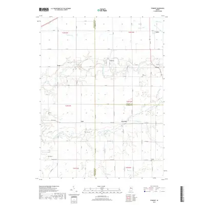
2019 Map of Pyrmont
USGS Topo · Published 2019About this map
Wildcat Creek and its southern counterpart, the Middle Fork Wildcat Creek, dominate the central topography of this Indiana landscape. The rural settlements of Pyrmont, Edna Mills, and Owasco appear along these waterways, reflecting a legacy of river-dependent development. For genealogists, the map is a primary resource for locating several local burying grounds, including Saint Johns Cem near Owasco and Zion Cem to the west. The area's agricultural character is defined by an extensive network of drainage features like Shaftey Ditch, Deiter Ditch, and Sheets Ditch, which manage the low-lying terrain between small population centers. Unique landmarks such as The Mound in the southwest corner suggest significant geographical or cultural sites within the township grid, while the convergence of county lines for Tippecanoe, Carroll, and Clinton highlights the map's position at a tri-county junction.
Find a feature on this map
65 named features on this map. Tap any name to fly to it.
Don’t see what you’re looking for? This feature index may not catch every label — zoom into the map to look around manually.
Map Details
Editions of this 2019 Pyrmont Map
This is the sole edition of this map. No revisions or reprints were ever made.
Other maps of this area

1953 · Danville
USGS Topo · 1:250,000

1955 · Danville
USGS Topo · 1:250,000

1956 · Danville
USGS Topo · 1:250,000

1961 · Mulberry
USGS Topo · 1:24,000

1961 · Pyrmont
USGS Topo · 1:24,000

1961 · Stockwell
USGS Topo · 1:24,000

1961 · Lafayette East
USGS Topo · 1:24,000

1961 · Rossville
USGS Topo · 1:24,000

1961 · Frankfort
USGS Topo · 1:24,000

1962 · Flora
USGS Topo · 1:24,000