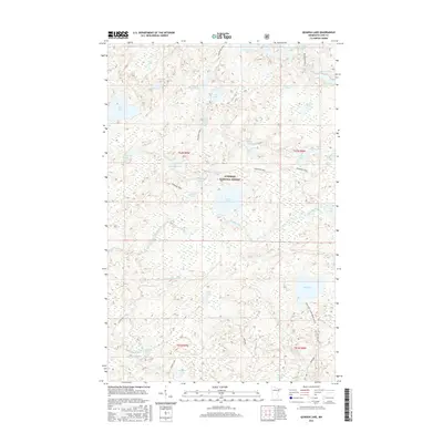
2016 Map of Quadga Lake
USGS Topo · Published 2016About this map
Superior National Forest encompasses this entire northern landscape, defined by a complex network of glacial lakes and river systems. The Powwow Trail winds through the northern half of the quadrangle, passing by numerous named water bodies including Rock of Ages Lake, Mirror Lake, and Campfire Lake. This region in Lake County is characterized by its hydrological density, where the Isabella River and Little Isabella River drain through marshlands and dense woodlands. The southern portion of the sheet highlights the accessibility of these remote waters, specifically at Bog Lake where the Bog Lake Carry Down Access is noted. Named lakes like Quadga Lake and Superstition Lake suggest the localized nomenclature of early twentieth-century exploration and forestry management within this protected wilderness area.
Find a feature on this map
45 named features on this map. Tap any name to fly to it.
Don’t see what you’re looking for? This feature index may not catch every label — zoom into the map to look around manually.
Map Details
Editions of this 2016 Quadga Lake Map
This is the sole edition of this map. No revisions or reprints were ever made.
Other maps of this area

1954 · Greenwood Lake
USGS Topo · 1:62,500

1954 · Two Harbors
USGS Topo · 1:250,000

1955 · Isabella
USGS Topo · 1:62,500

1957 · Two Harbors
USGS Topo · 1:250,000

1957 · Gabbro Lake
USGS Topo · 1:62,500

1958 · Two Harbors
USGS Topo · 1:250,000

1964 · Two Harbors
USGS Topo · 1:250,000
1981 · Snowbank Lake
USGS Topo · 1:24,000
1981 · Lake Insula
USGS Topo · 1:24,000
1981 · Gabbro Lake
USGS Topo · 1:24,000