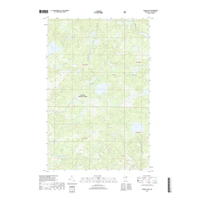
2019 Map of Quadga Lake
USGS Topo · Published 2019About this map
Superior National Forest encompasses this entire northern landscape, a dense network of glacial lakes and waterways within Lake County. The Isabella River and Little Isabella River meander through the central and southern portions of the map, feeding into numerous smaller bodies of water such as Quadga Lake, Bog Lake, and Janis Lake. This environment is characterized by its relative lack of modern road infrastructure, relying instead on historical paths like the Powwow Trail which bisects the northern terrain.
Find a feature on this map
36 named features on this map. Tap any name to fly to it.
Don’t see what you’re looking for? This feature index may not catch every label — zoom into the map to look around manually.
Map Details
Editions of this 2019 Quadga Lake Map
This is the sole edition of this map. No revisions or reprints were ever made.
Other maps of this area

1954 · Greenwood Lake
USGS Topo · 1:62,500

1954 · Two Harbors
USGS Topo · 1:250,000

1955 · Isabella
USGS Topo · 1:62,500

1957 · Two Harbors
USGS Topo · 1:250,000

1957 · Gabbro Lake
USGS Topo · 1:62,500

1958 · Two Harbors
USGS Topo · 1:250,000

1964 · Two Harbors
USGS Topo · 1:250,000
1981 · Snowbank Lake
USGS Topo · 1:24,000
1981 · Lake Insula
USGS Topo · 1:24,000
1981 · Gabbro Lake
USGS Topo · 1:24,000