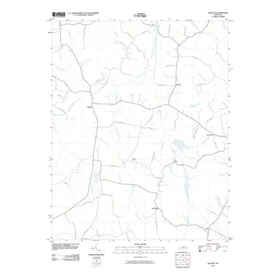
2010 Map of Quality
USGS Topo · Published 2010About this map
Muddy Creek and its many tributaries, including Boston Lick Creek and Brushy Fork, define the drainage patterns of this rural Butler County landscape. Small crossroads settlements like Quality, Boston, and Turnertown anchor the local road network, which is heavily shaped by family-named routes such as Roy Givens Rd and Hamilton Lee Rd. For genealogists, the map is a primary source for locating rural burial sites like Duncan Cemetery and Smith Cemetery, as well as landmarks like Lees Bridge. The abundance of local branches and forks, such as Forgys Branch and Flat Rock Branch, illustrates the dissected terrain that influenced historical settlement and agricultural boundaries in this corner of Kentucky.
Find a feature on this map
50 named features on this map. Tap any name to fly to it.
Don’t see what you’re looking for? This feature index may not catch every label — zoom into the map to look around manually.
Map Details
Editions of this 2010 Quality Map
This is the sole edition of this map. No revisions or reprints were ever made.
Other maps of this area

1911 · Dunmor
USGS Topo · 1:48,000

1914 · Little Muddy
USGS Topo · 1:62,500

1914 · Dunmor
USGS Topo · 1:62,500

1951 · Lewisburg
USGS Topo · 1:24,000

1951 · South Union
USGS Topo · 1:24,000

1951 · Homer
USGS Topo · 1:24,000

1953 · Dunmor
USGS Topo · 1:24,000

1953 · South Hill
USGS Topo · 1:24,000

1953 · Quality
USGS Topo · 1:24,000

1953 · Rochester
USGS Topo · 1:24,000