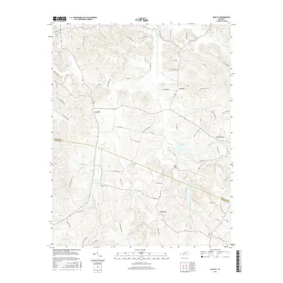
2016 Map of Quality
USGS Topo · Published 2016About this map
The borderlands of Butler and Logan Counties define this rural landscape, where the settlements of Quality and Boston serve as central nodes for the surrounding agricultural community. The terrain is deeply carved by water, with Muddy Creek and its many tributaries, such as Boston Lick Cr and Dallam Cr, creating a network of ridges and bottoms. Family legacies are etched into the road names and landmarks throughout the quadrangle, including several sites associated with the Givens family like Givens Cemetery and Roy Givens Rd. The presence of Lees Bridge over Muddy Creek and the localized development at Turnertown and Anderson illustrate a traditional Kentucky settlement pattern focused on waterway proximity and high-ground crossings. This modern survey provides a clear view of the longstanding rural infrastructure, from Smith Cem to the former location of the Boston School.
Find a feature on this map
68 named features on this map. Tap any name to fly to it.
Don’t see what you’re looking for? This feature index may not catch every label — zoom into the map to look around manually.
Map Details
Editions of this 2016 Quality Map
This is the sole edition of this map. No revisions or reprints were ever made.
Other maps of this area

1911 · Dunmor
USGS Topo · 1:48,000

1914 · Little Muddy
USGS Topo · 1:62,500

1914 · Dunmor
USGS Topo · 1:62,500

1951 · Lewisburg
USGS Topo · 1:24,000

1951 · South Union
USGS Topo · 1:24,000

1951 · Homer
USGS Topo · 1:24,000

1953 · Dunmor
USGS Topo · 1:24,000

1953 · South Hill
USGS Topo · 1:24,000

1953 · Quality
USGS Topo · 1:24,000

1953 · Rochester
USGS Topo · 1:24,000