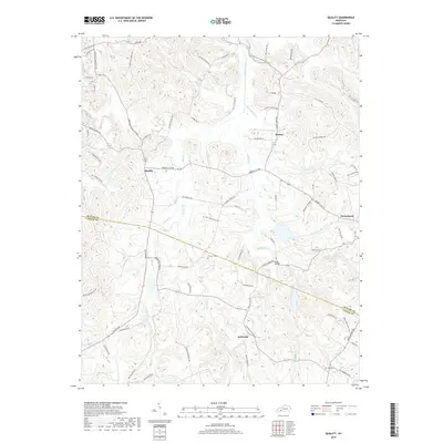
2019 Map of Quality
USGS Topo · Published 2019About this map
Quality and the surrounding Butler County countryside are defined by a complex network of creeks and small family-named settlements. The landscape is carved by the drainages of Muddy Creek and its tributaries, including Boston Lick Cr and Biggerstaff Cr. This 2019 survey documents a rural landscape where history is preserved in numerous family burial grounds such as Gills Cemetery and the Tines Cemetery near Turnertown. The distribution of residential labels around Anderson and Boston suggests a pattern of homesteads linked by an intricate web of roads like Berry's Lick Rd and Anderson Store Rd. The terrain is also marked by larger agricultural holdings, notably 4-D Farms in the north and the quiet waters of Davis Lake to the west. These features reflect a persistent rural economy where land is often identified by the families who have long managed it.
Find a feature on this map
83 named features on this map. Tap any name to fly to it.
Don’t see what you’re looking for? This feature index may not catch every label — zoom into the map to look around manually.
Map Details
Editions of this 2019 Quality Map
This is the sole edition of this map. No revisions or reprints were ever made.
Other maps of this area

1911 · Dunmor
USGS Topo · 1:48,000

1914 · Little Muddy
USGS Topo · 1:62,500

1914 · Dunmor
USGS Topo · 1:62,500

1951 · Lewisburg
USGS Topo · 1:24,000

1951 · South Union
USGS Topo · 1:24,000

1951 · Homer
USGS Topo · 1:24,000

1953 · Dunmor
USGS Topo · 1:24,000

1953 · South Hill
USGS Topo · 1:24,000

1953 · Quality
USGS Topo · 1:24,000

1953 · Rochester
USGS Topo · 1:24,000