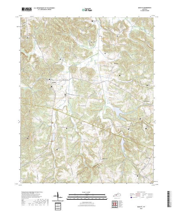
2022 Map of Quality
USGS Topo · Published 2022About this map
Quality and Boston anchor this section of Kentucky, where the landscape is defined by the winding course of Muddy Creek and its many tributaries. The area's settlement pattern is reflected in the high density of family and community burial grounds, such as the New Zion Cem and Union Grove Cem, often situated near rural road intersections. The boundary between Butler and Logan counties bisects the southern half of the sheet, crossing through the hills just south of the Quality Baptist Church Cem. Transport in this region relies on a network of named rural routes like Berry's Lick Rd and Huntsville-Quality Rd, which connect the scattered small communities of Anderson and Turnertown to the surrounding farmland and creeks.
Find a feature on this map
99 named features on this map. Tap any name to fly to it.
Don’t see what you’re looking for? This feature index may not catch every label — zoom into the map to look around manually.
Map Details
Editions of this 2022 Quality Map
This is the sole edition of this map. No revisions or reprints were ever made.
Other maps of this area

1911 · Dunmor
USGS Topo · 1:48,000

1914 · Little Muddy
USGS Topo · 1:62,500

1914 · Dunmor
USGS Topo · 1:62,500

1951 · Lewisburg
USGS Topo · 1:24,000

1951 · South Union
USGS Topo · 1:24,000

1951 · Homer
USGS Topo · 1:24,000

1953 · Dunmor
USGS Topo · 1:24,000

1953 · South Hill
USGS Topo · 1:24,000

1953 · Quality
USGS Topo · 1:24,000

1953 · Rochester
USGS Topo · 1:24,000