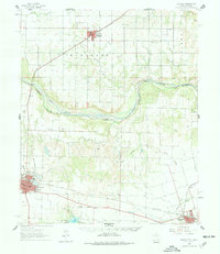
1960 Map of Quanah
USGS Topo · Published 1978About this map
The Red River corridor defines the boundary between Texas and Oklahoma in this 1960s-era landscape, where the agricultural plains of Hardeman County meet the river's winding path. Quanah and Chillicothe serve as the primary rail hubs, connected by the Fort Worth and Denver and the Panhandle and Santa Fe railroads. These transit lines supported a landscape of scattered rural institutions, including King Sch and the Midway Community Center, which anchored the local social fabric.
Find a feature on this map
41 named features on this map. Tap any name to fly to it.
Don’t see what you’re looking for? This feature index may not catch every label — zoom into the map to look around manually.
Map Details
Editions of this 1960 Quanah Map
3 editions found
Other maps of this area

1927 · Quanah 3-a
USGS Topo · 1:48,000

1932 · Vivian
USGS Topo · 1:62,500

1955 · Lawton
USGS Topo · 1:250,000

1958 · Vernon
USGS Topo · 1:62,500

1958 · Medicine Mound
USGS Topo · 1:62,500

1958 · Elmer
USGS Topo · 1:62,500

1960 · Goodlett
USGS Topo · 1:62,500

1960 · Teacup Mountain
USGS Topo · 1:62,500

1960 · Quanah
USGS Topo · 1:62,500

1961 · Hollis
USGS Topo · 1:62,500