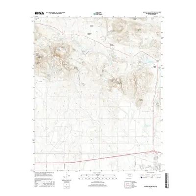
2016 Map of Quanah Mountain
USGS Topo · Published 2016About this map
The Wichita Mountains dominate this landscape, showcasing a complex network of peaks and water management systems. The southern portion of the map centers on the town of Cache, where a residential grid of streets like W Oak Ave and N 7th St transitions into the expansive wildlands to the north. This area is defined by its significant hydrology, featuring numerous named reservoirs such as Potawatomi Twins Reservoir, French Lake, and Quanah Parker Lake, which support the surrounding terrain.
Find a feature on this map
88 named features on this map. Tap any name to fly to it.
Don’t see what you’re looking for? This feature index may not catch every label — zoom into the map to look around manually.
Map Details
Editions of this 2016 Quanah Mountain Map
This is the sole edition of this map. No revisions or reprints were ever made.
Other maps of this area

1937 · Cache
USGS Topo · 1:48,000

1937 · Quanah Mountain
USGS Topo · 1:24,000

1942 · Cache
USGS Topo · 1:62,500

1949 · Mount Scott
USGS Topo · 1:24,000

1949 · Cooperton
USGS Topo · 1:62,500

1949 · Quanah Mountain
USGS Topo · 1:24,000

1950 · Snyder
USGS Topo · 1:62,500

1950 · Saddle Mountain
USGS Topo · 1:62,500

1955 · Lawton
USGS Topo · 1:250,000

1956 · Post Oak Creek
USGS Topo · 1:24,000