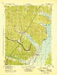
1944 Map of Quantico
USGS Topo · Published 1944About this map
Marine Corps Reservation land dominates the southern half of this 1944 terrain study, reflecting the significant military expansion along the Potomac River during the war years. The landscape is defined by the deep tidal inlets of Quantico Creek, Chopawamsic Creek, and Neabsco Creek, which dictated the layout of regional infrastructure. This era captures the primary transportation corridor through Prince William County, where the Highway and Jefferson Davis road run parallel to the Richmond Fredericksburg and Potomac railroad line.
Find a feature on this map
25 named features on this map. Tap any name to fly to it.
Don’t see what you’re looking for? This feature index may not catch every label — zoom into the map to look around manually.
Map Details
Editions of this 1944 Quantico Map
2 editions found
Other maps of this area

1889 · Fredericksburg
USGS Topo · 1:125,000

1890 · Mt. Vernon
USGS Topo · 1:125,000

1891 · Mt. Vernon
USGS Topo · 1:125,000

1892 · Fredericksburg
USGS Topo · 1:125,000

1894 · Fredericksburg
USGS Topo · 1:125,000

1894 · Mt. Vernon
USGS Topo · 1:125,000

1897 · Mt. Vernon
USGS Topo · 1:125,000

1913 · Indian Head
USGS Topo · 1:62,500

1913 · Nanjemoy
USGS Topo · 1:62,500

1923 · Indian Head
USGS Topo · 1:48,000