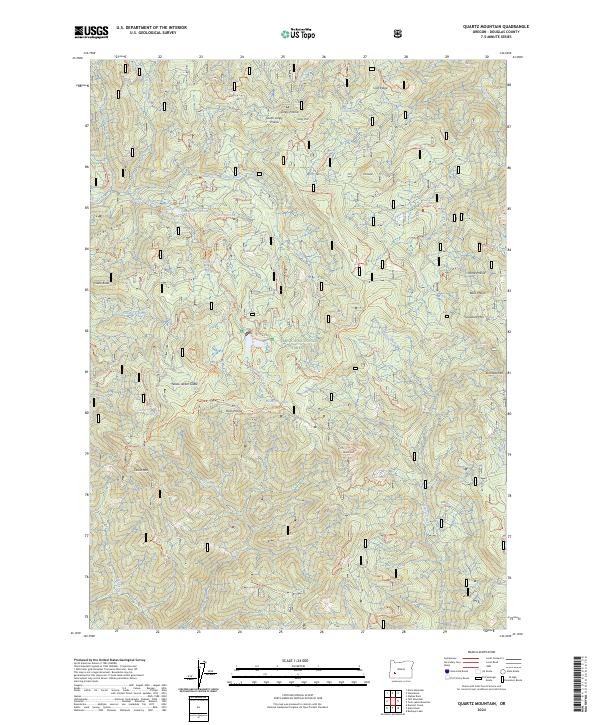
2024 Map of Quartz Mountain
USGS Topo · Published 2024About this map
Umpqua National Forest defines this high-elevation landscape in Douglas County, where a network of forest service roads and trails connects numerous peaks and remote clearings. The terrain is characterized by prominent summits like Quartz Mountain and Snowbird Mountain, interspersed with high-country openings such as Horse Prairie and Yellow Jacket Glade. Small, secluded water bodies including Dead Cow Lake and Lake in the Woods are tucked between ridges, serving as vital drainage points for the many named creeks that carve through the forest.
Find a feature on this map
60 named features on this map. Tap any name to fly to it.
Don’t see what you’re looking for? This feature index may not catch every label — zoom into the map to look around manually.
Map Details
Editions of this 2024 Quartz Mountain Map
This is the sole edition of this map. No revisions or reprints were ever made.
Other maps of this area

1955 · Quartz Mtn
USGS Topo · 1:62,500

1955 · Red Butte
USGS Topo · 1:62,500

1955 · Mace Mtn
USGS Topo · 1:62,500

1955 · Illahee Rock
USGS Topo · 1:62,500

1958 · Roseburg
USGS Topo · 1:250,000

1959 · Roseburg
USGS Topo · 1:250,000

1978 · Diamond Lake
USGS Topo · 1:100,000
1989 · Acker Rock
USGS Topo · 1:24,000
1989 · Taft Mountain
USGS Topo · 1:24,000
1989 · Twin Lakes Mountain
USGS Topo · 1:24,000