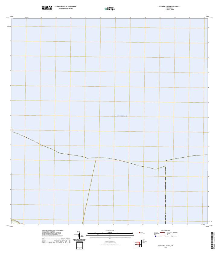
2024 Map of Quebradillas OE N
USGS Topo · Published 2024About this map
The Atlantic Ocean dominates this coastal survey, which focuses on the waters just off the northern coast of Puerto Rico. Produced by the U.S. Geological Survey, this 2024 sheet primarily illustrates the maritime expanse and the subtle variations of the offshore environment. Because the map is almost entirely composed of open water, it serves as a distinct record of the littoral boundary where the island's northern edge meets the sea. The absence of terrestrial features highlights the specific hydrographic focus of this quadrangle, preserving the modern shoreline and maritime coordinates for this specific section of the Atlantic.
Find a feature on this map
1 named feature on this map. Tap any name to fly to it.
Don’t see what you’re looking for? This feature index may not catch every label — zoom into the map to look around manually.
Map Details
Editions of this 2024 Quebradillas OE N Map
This is the sole edition of this map. No revisions or reprints were ever made.
Other maps of this area

1937 · Moca
USGS Topo · 1:20,000

1938 · Camuy
USGS Topo · 1:20,000

1938 · Quebradillas
USGS Topo · 1:20,000

1941 · Moca
USGS Topo · 1:30,000

1941 · Isabela
USGS Topo · 1:30,000

1942 · Moca
USGS Topo · 1:30,000

1942 · Camuy
USGS Topo · 1:30,000
1950 · Moca NE
USGS Topo · 1:10,000
1950 · Quebradillas NO
USGS Topo · 1:10,000
1950 · Isabela SE
USGS Topo · 1:10,000