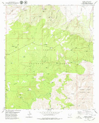
1979 Map of Queen
USGS Topo · Published 1979About this map
The settlement of Queen and the surrounding wilderness of the Lincoln National Forest characterize this late-1970s survey of the Guadalupe Mountains. Life in this arid landscape centered on water management, evidenced by the numerous tanks and wells such as Priestly Tank, Watkins Tank, and Cottonwood Well. The area served as a focal point for both spiritual and civic activity, hosting the Guadalupe Church Camp and the Guadalupe Administrative Site.
Find a feature on this map
66 named features on this map. Tap any name to fly to it.
Don’t see what you’re looking for? This feature index may not catch every label — zoom into the map to look around manually.
Map Details
Editions of this 1979 Queen Map
2 editions found
Other maps of this area

1935 · El Paso Gap
USGS Topo · 1:62,500

1936 · El Paso Gap
USGS Topo · 1:48,000

1940 · El Paso Gap
USGS Topo · 1:62,500

1940 · Bandanna Point
USGS Topo · 1:62,500

1940 · Carlsbad Caverns West
USGS Topo · 1:62,500

1943 · Carlsbad Caverns West
USGS Topo · 1:62,500

1943 · Bandanna Point
USGS Topo · 1:62,500

1943 · Texas Hill
USGS Topo · 1:62,500

1945 · Texas Hill
USGS Topo · 1:62,500

1954 · Carlsbad
USGS Topo · 1:250,000