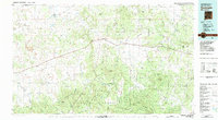
1983 Map of Quemado
USGS Topo · Published 1983About this map
Quemado stands at the center of this high-altitude landscape in Catron County, where the Continental Divide winds through the northern reaches of the Apache National Forest and Cibola National Forest. The settlement patterns of the early 1980s are defined by the convergence of Us 60 and NM 32, serving small communities like Omega and Collinsville. To the north, the isolated Adams Diggings and the curious Salt Lake break up the vast drainage basins of Largo Creek and Augustine Draw. The terrain is characterized by massive volcanic and sedimentary features, including the Sawtooth Mountains, Mangas Mountain, and the distinctive Mesita Blanca. This map documents a transition from cattle ranching country into the dense timber of the Gallo Mountains, showing how local roads navigate complex mountain passes like Dutch Oven Pass and Knight Gap.
Find a feature on this map
88 named features on this map. Tap any name to fly to it.
Don’t see what you’re looking for? This feature index may not catch every label — zoom into the map to look around manually.
Map Details
Editions of this 1983 Quemado Map
2 editions found
Other maps of this area

1886 · St Johns
USGS Topo · 1:250,000

1892 · St Johns
USGS Topo · 1:250,000

1915 · Reserve
USGS Topo · 1:125,000

1917 · Broom Mountain
USGS Topo · 1:125,000

1918 · Pelona
USGS Topo · 1:125,000

1918 · Reserve
USGS Topo · 1:125,000

1922 · Nutrioso
USGS Topo · 1:125,000

1954 · Tularosa
USGS Topo · 1:250,000

1954 · Clifton
USGS Topo · 1:250,000

1954 · Saint Johns
USGS Topo · 1:250,000