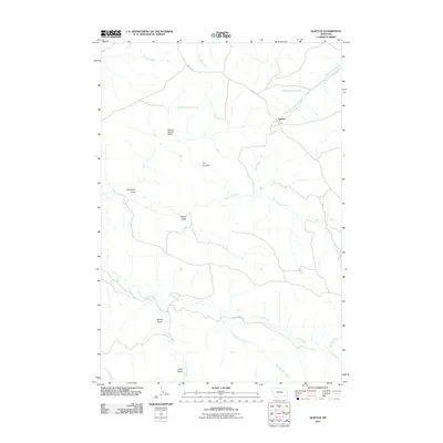
2011 Map of Quietus
USGS Topo · Published 2011About this map
Quietus stands at a remote crossroads in the Big Horn County backcountry, where the northern high plains break into a complex system of drainage draws and springs. This 2011 survey reveals a landscape defined by its hydrology and livestock-supporting terrain, anchored by local routes like Otter Rd and Decker Rd. The map is characterized by numerous named topographic depressions such as Canyon Spring Draw and Stagmire Draw, which channel seasonal water toward Mud-Springs Creek and the southern Trail Creek. Notable landmarks like The Pyramid rise above the surrounding flats, providing orientation in a region of few structures. The naming of features like Seventysix Creek and Tidwell Draw points to the cattle ranching heritage of southeastern Montana, where every spring and draw was critical for navigation and grazing.
Find a feature on this map
24 named features on this map. Tap any name to fly to it.
Don’t see what you’re looking for? This feature index may not catch every label — zoom into the map to look around manually.
Map Details
Editions of this 2011 Quietus Map
This is the sole edition of this map. No revisions or reprints were ever made.
Other maps of this area

1954 · Hardin
USGS Topo · 1:250,000

1955 · Sheridan
USGS Topo · 1:250,000

1957 · Hardin
USGS Topo · 1:250,000

1958 · Hardin
USGS Topo · 1:250,000

1958 · Sheridan
USGS Topo · 1:250,000

1962 · Sheridan
USGS Topo · 1:250,000
1971 · Roundup Draw
USGS Topo · 1:24,000

1971 · Cabin Creek NW
USGS Topo · 1:24,000
1971 · Box Elder Draw
USGS Topo · 1:24,000
1972 · Stroud Creek
USGS Topo · 1:24,000