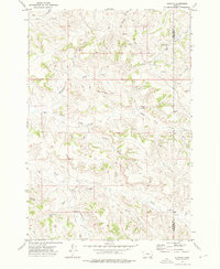
1972 Map of Quietus
USGS Topo · Published 1976About this map
Quietus sits at the center of this high-plains landscape on the border of Big Horn and Powder River counties. The area is defined by a dense network of seasonal drainages and named coulees, including Davidson Draw, Mull Draw, and Jojo Draw, which carve through the high terrain. Human activity is sparse and dictated by the water and geology of the region, evidenced by numerous Gravel Pits and isolated Drill Holes.
Find a feature on this map
33 named features on this map. Tap any name to fly to it.
Don’t see what you’re looking for? This feature index may not catch every label — zoom into the map to look around manually.
Map Details
Editions of this 1972 Quietus Map
This is the sole edition of this map. No revisions or reprints were ever made.
Other maps of this area

1954 · Hardin
USGS Topo · 1:250,000

1955 · Sheridan
USGS Topo · 1:250,000

1957 · Hardin
USGS Topo · 1:250,000

1958 · Hardin
USGS Topo · 1:250,000

1958 · Sheridan
USGS Topo · 1:250,000

1962 · Sheridan
USGS Topo · 1:250,000
1971 · Roundup Draw
USGS Topo · 1:24,000

1971 · Cabin Creek NW
USGS Topo · 1:24,000
1971 · Box Elder Draw
USGS Topo · 1:24,000
1972 · Stroud Creek
USGS Topo · 1:24,000