
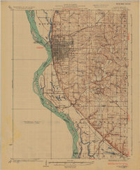
1925 Map of Quincy
USGS Topo · Published 1925About this map
The city of Quincy dominates the river bluffs above the Mississippi River in this 1922 survey, showcasing a dense urban grid and a complex riverfront economy. Rail lines like the Chicago Burlington and Quincy converge on the city, while the river's eastern bank is a maze of side channels and islands, including Cottonwood Island and Ward Island. The inland landscape is remarkably dense with rural institutions, mapping dozens of community centers such as Melrose School, St Anthony School, and Melrose Chapel.
Find a feature on this map
73 named features on this map. Tap any name to fly to it.
Don’t see what you’re looking for? This feature index may not catch every label — zoom into the map to look around manually.
Map Details
Editions of this 1925 Quincy Map
2 editions found
Other maps of this area

1903 · Kahoka
USGS Topo · 1:125,000

1903 · Palmyra
USGS Topo · 1:125,000

1925 · Liberty
USGS Topo · 1:62,500

1927 · Liberty
USGS Topo · 1:62,500

1931 · Barry
USGS Topo · 1:62,500

1932 · Hannibal
USGS Topo · 1:62,500

1936 · Hannibal
USGS Topo · 1:48,000

1936 · Barry
USGS Topo · 1:48,000

1944 · Barry
USGS Topo · 1:62,500

1944 · Quincy
USGS Topo · 1:62,500