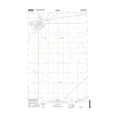
2017 Map of Quincy
USGS Topo · Published 2017About this map
Quincy sits at the heart of an organized agricultural grid, where the West Canal serves as a vital artery for the region's irrigation. This 2017 survey by the U.S. Geological Survey illustrates the intersection of intensive farming and municipal development in Grant County. The layout of the town is defined by a systematic street plan, including Division St E and A St NE, while the local infrastructure is anchored by the Po and the Quincy Municipal Airport to the south. The surrounding landscape is characterized by a dense network of numbered section roads, such as RD 10 NW and Farm Rd, reflecting the meticulous land management overseen by the Qcbid. The map provides a clear view of the transition from the concentrated residential blocks of the town center to the expansive acreage of the Columbia Basin.
Find a feature on this map
73 named features on this map. Tap any name to fly to it.
Don’t see what you’re looking for? This feature index may not catch every label — zoom into the map to look around manually.
Map Details
Editions of this 2017 Quincy Map
This is the sole edition of this map. No revisions or reprints were ever made.
Other maps of this area

1909 · Quincy
USGS Topo · 1:62,500

1910 · Quincy
USGS Topo · 1:62,500

1910 · Winchester
USGS Topo · 1:62,500

1953 · Ritzville
USGS Topo · 1:250,000

1956 · Ephrata
USGS Topo · 1:62,500

1956 · Ephrata SW
USGS Topo · 1:24,000

1959 · Ritzville
USGS Topo · 1:250,000

1965 · Ritzville
USGS Topo · 1:250,000
1966 · Winchester
USGS Topo · 1:24,000
1966 · Monument Hill
USGS Topo · 1:24,000