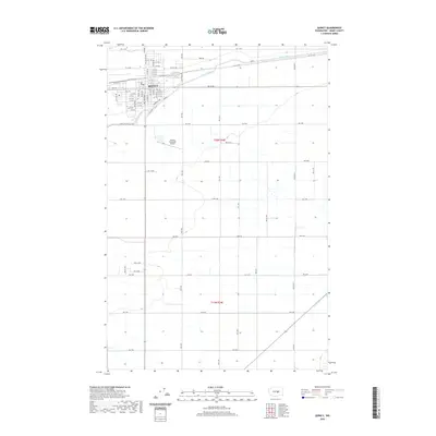
2020 Map of Quincy
USGS Topo · Published 2020About this map
Quincy is depicted here as a growing hub of central Washington, defined by its rigid grid of residential streets and the vital engineering of the West Canal. The town's layout, anchored by Division St W and Division St E, reflects a modern agricultural and transit center supported by the surrounding expanse of Grant County. This 2020 survey highlights the organized landscape of the Columbia Basin, where the precision of irrigation infrastructure meets the commercial needs of the region.
Find a feature on this map
69 named features on this map. Tap any name to fly to it.
Don’t see what you’re looking for? This feature index may not catch every label — zoom into the map to look around manually.
Map Details
Editions of this 2020 Quincy Map
This is the sole edition of this map. No revisions or reprints were ever made.
Other maps of this area

1909 · Quincy
USGS Topo · 1:62,500

1910 · Quincy
USGS Topo · 1:62,500

1910 · Winchester
USGS Topo · 1:62,500

1953 · Ritzville
USGS Topo · 1:250,000

1956 · Ephrata
USGS Topo · 1:62,500

1956 · Ephrata SW
USGS Topo · 1:24,000

1959 · Ritzville
USGS Topo · 1:250,000

1965 · Ritzville
USGS Topo · 1:250,000
1966 · Winchester
USGS Topo · 1:24,000
1966 · Monument Hill
USGS Topo · 1:24,000