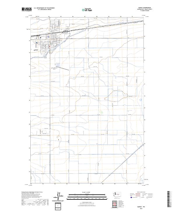
2023 Map of Quincy
USGS Topo · Published 2023About this map
Quincy is depicted here as a focal point of irrigation and infrastructure within Grant County. The town layout is clearly defined by a grid of streets including Division St W and A St NE, while the surrounding landscape is partitioned by an extensive network of numbered roads from Rd 11 NW down to Rd 3 NW. The West Canal cuts through the northern sections, tracing the elevation contours and highlighting the engineering necessary for the region's agricultural productivity. Local landmarks such as the Quincy Municipal Airport and the Quincy Cem provide essential reference points for genealogists and local historians studying the town's modern development. The map also delineates the township and range boundaries for t20n r24e and t19n r24e, offering a precise view of land division in this part of Washington.
Find a feature on this map
51 named features on this map. Tap any name to fly to it.
Don’t see what you’re looking for? This feature index may not catch every label — zoom into the map to look around manually.
Map Details
Editions of this 2023 Quincy Map
This is the sole edition of this map. No revisions or reprints were ever made.
Other maps of this area

1909 · Quincy
USGS Topo · 1:62,500

1910 · Quincy
USGS Topo · 1:62,500

1910 · Winchester
USGS Topo · 1:62,500

1953 · Ritzville
USGS Topo · 1:250,000

1956 · Ephrata
USGS Topo · 1:62,500

1956 · Ephrata SW
USGS Topo · 1:24,000

1959 · Ritzville
USGS Topo · 1:250,000

1965 · Ritzville
USGS Topo · 1:250,000
1966 · Winchester
USGS Topo · 1:24,000
1966 · Monument Hill
USGS Topo · 1:24,000