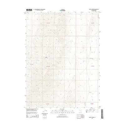
2014 Map of Quincy Spring
USGS Topo · Published 2014About this map
The Cedar Mountains dominate this high-desert landscape in Tooele County, where water is the primary driver of the few named landmarks. Significant water sources like Quincy Spring and Eightmile Spring are the focal points for the local transportation network, serving as essential hubs for the unpaved routes that cross the terrain. The map documents a sparsely populated region defined by its rugged topography and the functional utility of roads such as Quincy Spring Rd and Stock Rd. These tracks follow the contours of the mountain range, indicating a landscape used for livestock or transit between more settled areas of the Great Basin. The grid of township and range lines, including t3s r10w, provides a structured view of this open country, illustrating how surveyors partitioned the arid west even in its most isolated reaches.
Find a feature on this map
13 named features on this map. Tap any name to fly to it.
Don’t see what you’re looking for? This feature index may not catch every label — zoom into the map to look around manually.
Map Details
Editions of this 2014 Quincy Spring Map
This is the sole edition of this map. No revisions or reprints were ever made.
Other maps of this area

1885 · Tooele Valley
USGS Topo · 1:250,000

1953 · Tooele
USGS Topo · 1:250,000

1955 · Tabbys Peak
USGS Topo · 1:24,000

1955 · Wig Mtn NE
USGS Topo · 1:24,000

1955 · Tooele
USGS Topo · 1:250,000

1973 · Hastings Pass NE
USGS Topo · 1:24,000

1973 · Quincy Spring
USGS Topo · 1:24,000

1973 · Hastings Pass
USGS Topo · 1:24,000

1973 · Aragonite SE
USGS Topo · 1:24,000

1973 · Hickman Knolls
USGS Topo · 1:24,000