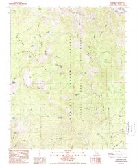
1988 Map of Quinn Peak
USGS Topo · Published 1988About this map
Quinn Peak dominates this high-altitude landscape in the Sierra Nevada, marking a point where the boundaries of the Sequoia National Park and Sequoia National Forest meet. The terrain is characterized by high alpine basins and several clusters of remote water bodies, including Blossom Lakes, Twin Lakes, and Maggie Lakes. Historically, the area supported scattered mountain habitations and resource extraction, evidenced by the presence of the Pine Tree Mine and numerous named dwellings such as Pecks Cabin, Walkers Cabin, and the Nelson Cabin. The transition from forest to wilderness is clear as the landscape rises toward the Great Western Divide, with significant drainages like the South Fork Kaweah River and the Little Kern River carving deep valleys through the Golden Trout Wilderness. This 1980s-era mapping records specific historical locations like the Broders Cabin and Newlywed sites, which remain important markers for backcountry historians.
Find a feature on this map
44 named features on this map. Tap any name to fly to it.
Don’t see what you’re looking for? This feature index may not catch every label — zoom into the map to look around manually.
Map Details
Editions of this 1988 Quinn Peak Map
2 editions found
Other maps of this area

1904 · Kaweah
USGS Topo · 1:125,000

1905 · Olancha
USGS Topo · 1:125,000

1907 · Olancha
USGS Topo · 1:125,000

1909 · Kaweah
USGS Topo · 1:125,000

1937 · Kaweah
USGS Topo · 1:125,000

1948 · Fresno
USGS Topo · 1:250,000

1955 · Fresno
USGS Topo · 1:250,000

1956 · Fresno
USGS Topo · 1:250,000

1956 · Hockett Peak
USGS Topo · 1:62,500

1956 · Mineral King
USGS Topo · 1:62,500