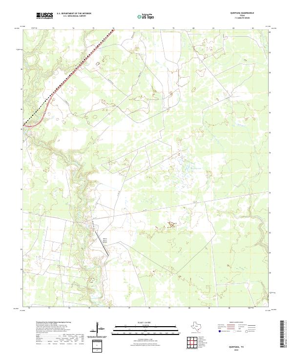
2022 Map of Quintana
USGS Topo · Published 2022About this map
Melon Cr and its winding tributaries dominate this Refugio County landscape, where the coastal prairie transitions into the drainage systems feeding into the Gulf. This 2022 survey captures a rural Texas environment defined by large-scale ranching and mineral extraction infrastructure, most notably the Mellon Ranch Airport and a network of specialized routes like T-C Oil Rd. The presence of Mustang Lake and extensive marshlands along the southeastern reaches of the quadrangle suggests a landscape heavily influenced by seasonal water levels and tidal influence from nearby bays.
Find a feature on this map
10 named features on this map. Tap any name to fly to it.
Don’t see what you’re looking for? This feature index may not catch every label — zoom into the map to look around manually.
Map Details
Editions of this 2022 Quintana Map
This is the sole edition of this map. No revisions or reprints were ever made.
Other maps of this area

1953 · Beeville
USGS Topo · 1:250,000

1954 · Rockport
USGS Topo · 1:62,500

1954 · Woodsboro
USGS Topo · 1:62,500

1954 · Vidaurri
USGS Topo · 1:62,500

1954 · Refugio
USGS Topo · 1:62,500

1956 · Beeville
USGS Topo · 1:250,000

1960 · Beeville
USGS Topo · 1:250,000

1978 · Woodsboro
USGS Topo · 1:24,000

1978 · Ryanville
USGS Topo · 1:24,000

1978 · Vidaurri
USGS Topo · 1:24,000