1979 Map of Quintana
USGS Topo · Published 1979About this map
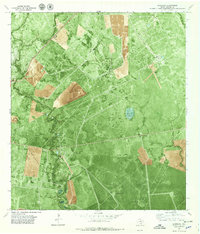
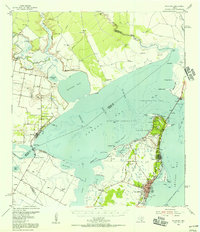
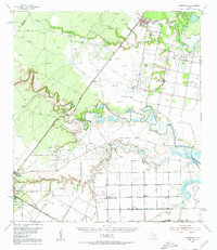
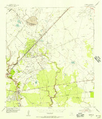
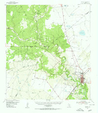
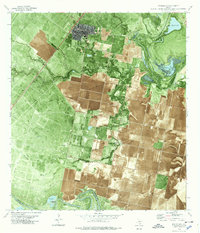
The Tom O'connor Oil Field dominates this Refugio County landscape, illustrating the extensive petroleum infrastructure of the Texas Coastal Bend in the late 1970s. This orthophotomap provides a clear view of the complex web of drilling operations, featuring high-density concentrations of wells, pipelines, and access roads across the Fox Oil Field and the Greta Oil Field. The small settlement of Quintana is situated near the Missouri Pacific railroad line, while several family-named or descriptively named flowing wells, such as the Saddle Blanket Well and Jack Fiat Well, underscore the local importance of specific groundwater and mineral rights. The terrain is defined by low-lying drainages like Melon Creek and Copano Creek, which feed into coastal water bodies including Mustang Lake and Arrowhead Lake.
Find a feature on this map
23 named features on this map. Tap any name to fly to it.
Don’t see what you’re looking for? This feature index may not catch every label — zoom into the map to look around manually.
Map Details
Editions of this 1979 Quintana Map
This is the sole edition of this map. No revisions or reprints were ever made.
Other maps of this area

1953 · Beeville
USGS Topo · 1:250,000
1954 · Rockport
USGS Topo · 1:62,500
1954 · Woodsboro
USGS Topo · 1:62,500
1954 · Vidaurri
USGS Topo · 1:62,500
1954 · Refugio
USGS Topo · 1:62,500

1956 · Beeville
USGS Topo · 1:250,000

1960 · Beeville
USGS Topo · 1:250,000
1978 · Woodsboro
USGS Topo · 1:24,000
1978 · Ryanville
USGS Topo · 1:24,000
1978 · Vidaurri
USGS Topo · 1:24,000