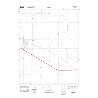
2012 Map of Quinter
USGS Topo · Published 2012About this map
Quinter serves as the primary hub of this western Kansas landscape, where the intersection of Main St and Lincoln St anchors a grid that reaches out toward the surrounding agricultural lands. The town is flanked by essential community landmarks, including the Quinter Air Strip Airport to the west and a local Post Office in the central business district. The township's heritage is preserved in sites like the Baker Township Cemetery on the northern outskirts and the Old Order German Baptist Cemetery further south, reflecting the area's deep-rooted settlement patterns.
Find a feature on this map
31 named features on this map. Tap any name to fly to it.
Don’t see what you’re looking for? This feature index may not catch every label — zoom into the map to look around manually.
Map Details
Editions of this 2012 Quinter Map
This is the sole edition of this map. No revisions or reprints were ever made.
Other maps of this area

1954 · Goodland
USGS Topo · 1:250,000

1955 · Scott City
USGS Topo · 1:250,000

1956 · Goodland
USGS Topo · 1:250,000

1957 · Goodland
USGS Topo · 1:250,000

1958 · Scott City
USGS Topo · 1:250,000

1972 · Gove NE
USGS Topo · 1:24,000

1972 · Castle Rock NW
USGS Topo · 1:24,000
1972 · Castle Rock NE
USGS Topo · 1:24,000

1979 · Park
USGS Topo · 1:24,000

1979 · Midway Draw East
USGS Topo · 1:24,000