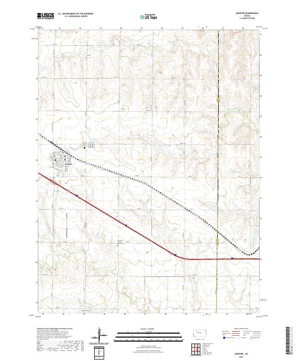
2022 Map of Quinter
USGS Topo · Published 2022About this map
Quinter sits at the heart of this Gove County landscape, a community defined by its straight-line grid and its position along a major transcontinental corridor. The terrain is etched by the drainages of Big Creek and Plum Creek, revealing a classic High Plains settlement pattern where ranch roads like Castle Rock Rd and Gove AA Rd divide the open country. Local history is anchored by the presence of the Baker Township Cem just north of town and the Old Order German Baptist Cem further south, signaling the enduring cultural and religious heritage of the area's early settlers. The transition from the historic Old Hwy 40 to the modern interstate corridor illustrates the evolution of Western Kansas travel, while Jamison Field to the south provides a quiet reference to the region's aviation and agricultural infrastructure.
Find a feature on this map
55 named features on this map. Tap any name to fly to it.
Don’t see what you’re looking for? This feature index may not catch every label — zoom into the map to look around manually.
Map Details
Editions of this 2022 Quinter Map
This is the sole edition of this map. No revisions or reprints were ever made.
Other maps of this area

1954 · Goodland
USGS Topo · 1:250,000

1955 · Scott City
USGS Topo · 1:250,000

1956 · Goodland
USGS Topo · 1:250,000

1957 · Goodland
USGS Topo · 1:250,000

1958 · Scott City
USGS Topo · 1:250,000

1972 · Gove NE
USGS Topo · 1:24,000

1972 · Castle Rock NW
USGS Topo · 1:24,000
1972 · Castle Rock NE
USGS Topo · 1:24,000

1979 · Park
USGS Topo · 1:24,000

1979 · Midway Draw East
USGS Topo · 1:24,000