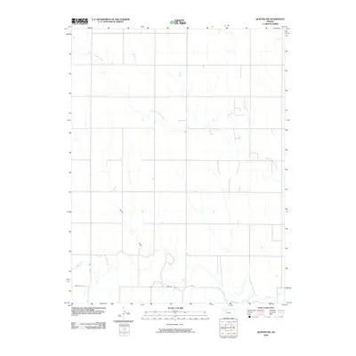
2009 Map of Quinter NW
USGS Topo · Published 2009About this map
The North Fork Saline River meanders through the northwest corner of Gove County, defining the drainage patterns of this High Plains landscape. In the southern portion of the quadrangle, the main Saline River channel cuts across the terrain, joined by smaller tributaries such as Plum Cr. The area is characterized by the typical Jeffersonian grid system, with local roads following section lines across the wide drainage basins of Turner Draw. This 2009 survey by the U.S. Geological Survey documents the rural infrastructure and hydraulic features of the region, illustrating the relationship between the seasonal watercourses and the agricultural land divisions in western Kansas.
Find a feature on this map
5 named features on this map. Tap any name to fly to it.
Don’t see what you’re looking for? This feature index may not catch every label — zoom into the map to look around manually.
Map Details
Editions of this 2009 Quinter NW Map
This is the sole edition of this map. No revisions or reprints were ever made.
Other maps of this area

1954 · Goodland
USGS Topo · 1:250,000

1956 · Goodland
USGS Topo · 1:250,000

1957 · Goodland
USGS Topo · 1:250,000

1979 · Park
USGS Topo · 1:24,000

1979 · Midway Draw East
USGS Topo · 1:24,000

1979 · Morland
USGS Topo · 1:24,000

1979 · Tasco
USGS Topo · 1:24,000

1979 · St Peter
USGS Topo · 1:24,000

1979 · Studley
USGS Topo · 1:24,000
1979 · Collyer
USGS Topo · 1:24,000