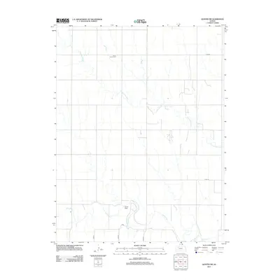
2012 Map of Quinter NW
USGS Topo · Published 2012About this map
Bethel Christian Cem serves as a lone landmark in this portion of Gove County, where the high plains landscape is defined by the winding paths of the Saline River and the N Fork Saline River. The drainage patterns here reveal a classic Western Kansas topography, with seasonal watercourses like Plum Cr and the distinct depression of Turner Draw carving through the agricultural grid. This 2012 survey illustrates the modern rural infrastructure, where local roads such as Co RD 74 and Co RD 76 follow the section lines that have governed the region since the original homestead era. The absence of major settlements highlights the enduringly remote and agrarian character of the High Plains, providing a clear record of land use and cemetery locations for researchers of local genealogy.
Find a feature on this map
11 named features on this map. Tap any name to fly to it.
Don’t see what you’re looking for? This feature index may not catch every label — zoom into the map to look around manually.
Map Details
Editions of this 2012 Quinter NW Map
This is the sole edition of this map. No revisions or reprints were ever made.
Other maps of this area

1954 · Goodland
USGS Topo · 1:250,000

1956 · Goodland
USGS Topo · 1:250,000

1957 · Goodland
USGS Topo · 1:250,000

1979 · Park
USGS Topo · 1:24,000

1979 · Midway Draw East
USGS Topo · 1:24,000

1979 · Morland
USGS Topo · 1:24,000

1979 · Tasco
USGS Topo · 1:24,000

1979 · St Peter
USGS Topo · 1:24,000

1979 · Studley
USGS Topo · 1:24,000
1979 · Collyer
USGS Topo · 1:24,000