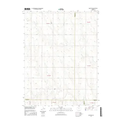
2015 Map of Quinter NW
USGS Topo · Published 2015About this map
The N Fork Saline River and the Saline River converge in this high plains landscape at the intersection of Gove, Sheridan, Graham, and Trego Counties. The terrain is defined by the gradual drainage patterns of the Turner Draw and the river forks, showing the open, surveyed sections of western Kansas. Cultural landmarks are sparse but significant for genealogy, most notably the Bethel Christian Cem located in the northern township of T9S R26W. The map documents a strictly rectilinear road network including Castle Rock Rd and several county routes like Gove 78, illustrating the enduring grid of the Public Land Survey System. This survey captures the rural character of the region where agricultural land and river bottomlands remain the primary features of the topography.
Find a feature on this map
32 named features on this map. Tap any name to fly to it.
Don’t see what you’re looking for? This feature index may not catch every label — zoom into the map to look around manually.
Map Details
Editions of this 2015 Quinter NW Map
This is the sole edition of this map. No revisions or reprints were ever made.
Other maps of this area

1954 · Goodland
USGS Topo · 1:250,000

1956 · Goodland
USGS Topo · 1:250,000

1957 · Goodland
USGS Topo · 1:250,000

1979 · Park
USGS Topo · 1:24,000

1979 · Midway Draw East
USGS Topo · 1:24,000

1979 · Morland
USGS Topo · 1:24,000

1979 · Tasco
USGS Topo · 1:24,000

1979 · St Peter
USGS Topo · 1:24,000

1979 · Studley
USGS Topo · 1:24,000
1979 · Collyer
USGS Topo · 1:24,000