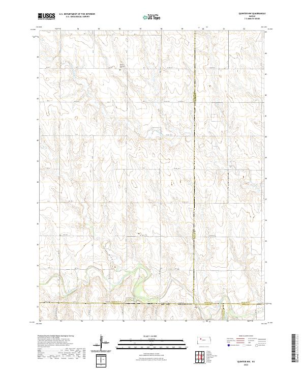
2022 Map of Quinter NW
USGS Topo · Published 2022About this map
The Bethel Christian Cem stands as a primary landmark in this rural pocket of the High Plains, situated near the northern boundary of the survey. The landscape is defined by the winding course of the N Fork Saline River, which carves through the undulating terrain as it flows toward its confluence with the Saline River. A complex grid of sectional roads, including Co RD 90 S and Co RD 110 S, facilitates movement across the vast agricultural sections of Sheridan and Graham counties. The southern portion of the area is marked by more pronounced drainages like Turner Draw and the arrival of Plum Cr, illustrating the watershed's transition as it nears the Gove and Trego county lines. This 2022 survey documents the persistent rural character of the region, where land use remains closely tied to the natural hydrology of the Saline River valley.
Find a feature on this map
38 named features on this map. Tap any name to fly to it.
Don’t see what you’re looking for? This feature index may not catch every label — zoom into the map to look around manually.
Map Details
Editions of this 2022 Quinter NW Map
This is the sole edition of this map. No revisions or reprints were ever made.
Other maps of this area

1954 · Goodland
USGS Topo · 1:250,000

1956 · Goodland
USGS Topo · 1:250,000

1957 · Goodland
USGS Topo · 1:250,000

1979 · Park
USGS Topo · 1:24,000

1979 · Midway Draw East
USGS Topo · 1:24,000

1979 · Morland
USGS Topo · 1:24,000

1979 · Tasco
USGS Topo · 1:24,000

1979 · St Peter
USGS Topo · 1:24,000

1979 · Studley
USGS Topo · 1:24,000
1979 · Collyer
USGS Topo · 1:24,000