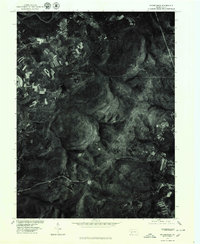
1977 Map of Rachelwood
USGS Topo · Published 1979About this map
The settlement of Rachelwood sits within a landscape defined by industrial and municipal water management as it appeared in the late 1970s. This orthophotoquad, produced by the U.S. Geological Survey in cooperation with the Soil Conservation Service, reveals the interplay between residential pockets and significant water infrastructure. The imagery highlights several key bodies of water, including the prominent Tubmill Reservoir and the North Fork Reservoir, which dominate the central and southeastern portions of the sheet. Unlike a traditional topographic map, this aerial perspective provides a clear view of the vegetation patterns and clearing boundaries surrounding Mirror Lake. It captures a specific moment in Westmoreland County's rural development, showing the expansion of roads and small settlements against the backdrop of the region's reservoirs and forested terrain.
Find a feature on this map
4 named features on this map. Tap any name to fly to it.
Don’t see what you’re looking for? This feature index may not catch every label — zoom into the map to look around manually.
Map Details
Editions of this 1977 Rachelwood Map
This is the sole edition of this map. No revisions or reprints were ever made.
Other maps of this area

1904 · Johnstown
USGS Topo · 1:62,500

1907 · Johnstown
USGS Topo · 1:62,500

1913 · Somerset
USGS Topo · 1:62,500

1914 · Windber
USGS Topo · 1:62,500

1915 · Somerset
USGS Topo · 1:62,500

1916 · Windber
USGS Topo · 1:62,500

1920 · New Florence
USGS Topo · 1:62,500

1921 · New Florence
USGS Topo · 1:48,000

1922 · New Florence
USGS Topo · 1:62,500

1944 · Somerset
USGS Topo · 1:62,500
Featured Places
- Jenner Township, PA
- Fairfield Township, PA
- Ligonier Township, PA
- Conemaugh Township, PA
- Lower Yoder Township, PA