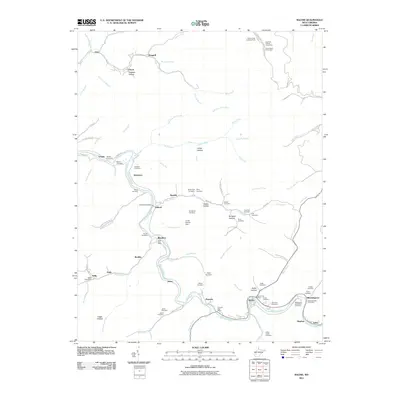
2011 Map of Racine
USGS Topo · Published 2011About this map
The Big Coal River carves a winding path through this region of West Virginia, serving as the central artery for a series of riverside settlements. Communities like Peytona, Racine, and Bloomingrose are concentrated along the riverbanks and narrow hollows, while the mountain interior is defined by an intricate network of streams such as Brier Creek, Lick Creek, and Draudy Creek. The prevalence of family and community burial grounds, including McDerment Cemetery, Perry Cemetery, and the Mechanics and Miners Cemetery, reflects a long-standing local heritage tied to the land and the region's extractive labor history.
Find a feature on this map
102 named features on this map. Tap any name to fly to it.
Don’t see what you’re looking for? This feature index may not catch every label — zoom into the map to look around manually.
Map Details
Editions of this 2011 Racine Map
This is the sole edition of this map. No revisions or reprints were ever made.
Other maps of this area

1899 · Charleston
USGS Topo · 1:125,000

1909 · Charleston
USGS Topo · 1:62,500

1909 · Peytona
USGS Topo · 1:48,000

1909 · Saint Albans
USGS Topo · 1:62,500

1911 · Peytona
USGS Topo · 1:62,500

1911 · Madison
USGS Topo · 1:62,500

1929 · Madison
USGS Topo · 1:62,500

1929 · Peytona
USGS Topo · 1:62,500

1931 · Madison
USGS Topo · 1:62,500

1931 · Saint Albans
USGS Topo · 1:62,500