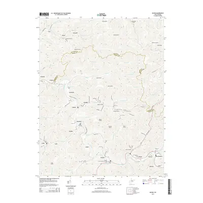
2014 Map of Racine
USGS Topo · Published 2014About this map
The Big Coal River carves through this portion of the Kanawha and Boone county border, anchoring a series of coal-country settlements including Peytona, Racine, and Bloomingrose. This 2014 survey documents a landscape defined by its deep hollows and narrow creek bottoms, such as Burgess Hollow and Longs Hollow, where small communities like Ashford, Rumble, and Brushton are situated. The density of family-named landmarks and burial sites provides a significant record for local genealogy, notably the Mechanics and Miners Cem near the river and the Snodgrass Cem tucked into the hills. Infrastructure like the R Carrico Memorial Bridge and the Peytona Bridge facilitate travel across the winding river valley. To the north, the terrain rises toward the Kanawha County line, marked by remote points like Dungriff and Olcott amidst the network of drainage forks including Bull Cr and Brier Cr.
Find a feature on this map
125 named features on this map. Tap any name to fly to it.
Don’t see what you’re looking for? This feature index may not catch every label — zoom into the map to look around manually.
Map Details
Editions of this 2014 Racine Map
This is the sole edition of this map. No revisions or reprints were ever made.
Other maps of this area

1899 · Charleston
USGS Topo · 1:125,000

1909 · Charleston
USGS Topo · 1:62,500

1909 · Peytona
USGS Topo · 1:48,000

1909 · Saint Albans
USGS Topo · 1:62,500

1911 · Peytona
USGS Topo · 1:62,500

1911 · Madison
USGS Topo · 1:62,500

1929 · Madison
USGS Topo · 1:62,500

1929 · Peytona
USGS Topo · 1:62,500

1931 · Madison
USGS Topo · 1:62,500

1931 · Saint Albans
USGS Topo · 1:62,500