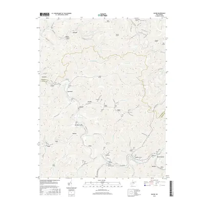
2016 Map of Racine
USGS Topo · Published 2016About this map
The Big Coal River winds through the southern portion of this landscape, anchoring the settlements of Peytona and Racine along its banks. This area of West Virginia is defined by a deep network of hollows and ridges, where narrow valleys like Holstein Hollow and Shrewsbury Hollow dictate the location of roads and small communities. The industrial and social history of the region is reflected in its many burial grounds, including the Mechanics and Miners Cem near Sharlow, suggesting the local labor heritage of the coalfields.
Find a feature on this map
133 named features on this map. Tap any name to fly to it.
Don’t see what you’re looking for? This feature index may not catch every label — zoom into the map to look around manually.
Map Details
Editions of this 2016 Racine Map
This is the sole edition of this map. No revisions or reprints were ever made.
Other maps of this area

1899 · Charleston
USGS Topo · 1:125,000

1909 · Charleston
USGS Topo · 1:62,500

1909 · Peytona
USGS Topo · 1:48,000

1909 · Saint Albans
USGS Topo · 1:62,500

1911 · Peytona
USGS Topo · 1:62,500

1911 · Madison
USGS Topo · 1:62,500

1929 · Madison
USGS Topo · 1:62,500

1929 · Peytona
USGS Topo · 1:62,500

1931 · Madison
USGS Topo · 1:62,500

1931 · Saint Albans
USGS Topo · 1:62,500