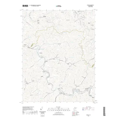
2019 Map of Racine
USGS Topo · Published 2019About this map
Peytona and Racine anchor this landscape along the winding course of the Big Coal River, where deep hollows like Foster Hollow and Snodgrass Hollow define the narrow valleys of Boone County. The presence of the Mechanics and Miners Cem near Bloomingrose reflects the region's long-standing connection to the extraction industries that shaped these West Virginia communities. Transport follows the river corridor, with the Walhonde Water Trail tracing the water's edge past Johns and Brushton. Infrastructure is marked by significant crossings including the Peytona Bridge and the Charles R Carrico Memorial Bridge. Scattered family and community burial grounds, such as Barker Cem, Javins Cem, and Price Cem, are found throughout the uplands, offering vital markers for genealogical research in this coalfield terrain.
Find a feature on this map
140 named features on this map. Tap any name to fly to it.
Don’t see what you’re looking for? This feature index may not catch every label — zoom into the map to look around manually.
Map Details
Editions of this 2019 Racine Map
This is the sole edition of this map. No revisions or reprints were ever made.
Other maps of this area

1899 · Charleston
USGS Topo · 1:125,000

1909 · Charleston
USGS Topo · 1:62,500

1909 · Peytona
USGS Topo · 1:48,000

1909 · Saint Albans
USGS Topo · 1:62,500

1911 · Peytona
USGS Topo · 1:62,500

1911 · Madison
USGS Topo · 1:62,500

1929 · Madison
USGS Topo · 1:62,500

1929 · Peytona
USGS Topo · 1:62,500

1931 · Madison
USGS Topo · 1:62,500

1931 · Saint Albans
USGS Topo · 1:62,500