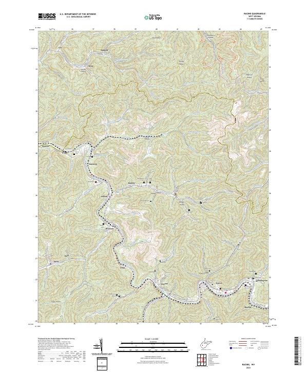
2023 Map of Racine
USGS Topo · Published 2023About this map
The Big Coal River carves a deep path through Boone County, anchoring the historical communities of Peytona and Racine. This 2023 survey illustrates a landscape defined by its coal-mining heritage and the rugged topography of the Appalachian Plateaus. The influence of the industry is visible in the presence of the Mechanics and Miners Cem near Bloomingrose, while the commercial transport corridor of CSX Transportation follows the river's winding course. To the north, the boundary between Kanawha Co and Boone Co cuts across the heavily dissected terrain of the Kanawha State Forest. Numerous family cemeteries, such as Javins Cem, Barker Cem, and Workman Cem, are scattered throughout the hollows and along the ridges, providing a detailed record for genealogists tracing the local lineage of settlements like Ashford and Nellis.
Find a feature on this map
135 named features on this map. Tap any name to fly to it.
Don’t see what you’re looking for? This feature index may not catch every label — zoom into the map to look around manually.
Map Details
Editions of this 2023 Racine Map
This is the sole edition of this map. No revisions or reprints were ever made.
Other maps of this area

1899 · Charleston
USGS Topo · 1:125,000

1909 · Charleston
USGS Topo · 1:62,500

1909 · Peytona
USGS Topo · 1:48,000

1909 · Saint Albans
USGS Topo · 1:62,500

1911 · Peytona
USGS Topo · 1:62,500

1911 · Madison
USGS Topo · 1:62,500

1929 · Madison
USGS Topo · 1:62,500

1929 · Peytona
USGS Topo · 1:62,500

1931 · Madison
USGS Topo · 1:62,500

1931 · Saint Albans
USGS Topo · 1:62,500