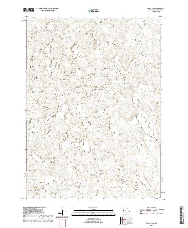
2021 Map of Rackett SE
USGS Topo · Published 2021About this map
Garden County's expansive Sandhills landscape is documented here in a 2021 study by the U.S. Geological Survey, revealing a terrain defined by subtle elevation changes and remote rural infrastructure. The mapping area is organized by the Public Land Survey System grids of t19n r42w, t19n r41w, t18n r42w, and t18n r41w, which coordinate this part of the Nebraska panhandle. Transportation in this high-plains environment is limited to a sparse network of county routes, notably Rushcreek Rd and Rd 215, which serve isolated ranching properties. These roads follow the natural contours of the land, providing vital links through a territory otherwise dominated by wind-sculpted topography and intermittent wetlands.
Find a feature on this map
7 named features on this map. Tap any name to fly to it.
Don’t see what you’re looking for? This feature index may not catch every label — zoom into the map to look around manually.
Map Details
Editions of this 2021 Rackett SE Map
This is the sole edition of this map. No revisions or reprints were ever made.
Other maps of this area

1897 · Ogallala
USGS Topo · 1:125,000

1900 · Chappell
USGS Topo · 1:125,000

1900 · Ogallala
USGS Topo · 1:125,000

1949 · Rackett
USGS Topo · 1:62,500

1950 · Velma
USGS Topo · 1:62,500

1951 · Rackett
USGS Topo · 1:62,500

1954 · Scottsbluff
USGS Topo · 1:250,000

1954 · North Platte
USGS Topo · 1:250,000

1956 · North Platte
USGS Topo · 1:250,000

1957 · North Platte
USGS Topo · 1:250,000